Sunday, April 19, 2015

14th Fieldwork Trip - 16th April 2015 - Between the Glasheen and Liberty Streams , Sarsfield House & Philipine House

Thursday 16th April 2015 was unique in two ways : It was unintentionally the very first time a Fieldwork Trip had been undertaken by the Togher Historical Association without the benefit of transport being completely executed on foot and it also rewarded the team with a rare inside view of Sarsfield House! Billy O'Brien took the opportunity whilst on foot down Wilton Road to photograph the Entrance gates to the S.M.A. - a body so instrumental in the Togher story over the last few Decades having bought up large tracts of land in Doughcloyne and other Townlands.


 View from Wilton Road of Sarsfield Flyover 
and Sarsfield Road in the distance


 S.M.A. entrance gates from Wilton Road


S.M.A. old side entrance gates from Wilton Rd.


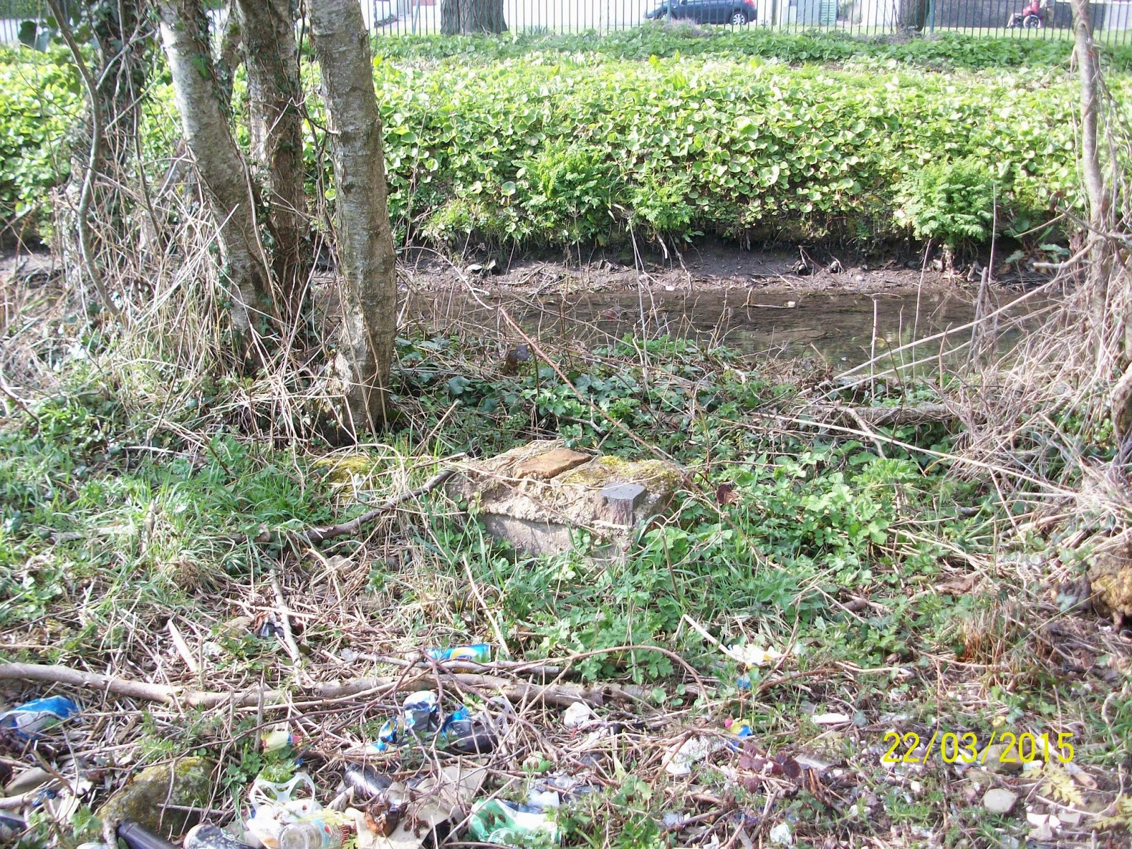
The Fieldwork Trip began with glorious sunshine as Billy O'Brien & Eamonn Pearse made an impromptu pit-stop at Sandbrook Bridge ( under which the Glasheen River flows ) for a quick photo exercise. One item of note came up for discussion ; that of the prevalence of numbered and lettered metal plates on the majority of footbridges found around Togher. The reason for their display is not yet known but is under investigation.


 Sandbrook Bridge with numbered plate
( left hand side entrance into Estate )


 View of Glasheen River from Sandbrook Bridge
( right hand side of bridge )

 View of Glasheen River from Sandbrook Bridge
( left hand side of bridge )


Close up of Glasheen from Sandbrook Bridge
( zoom in of above photo )


The Team decided at this juncture to pay a visit to the pedestrian bridge located halfway down the pathway at the rear of the Sarsfield Flyover towards Woodhaven Estate. It is thought that an old metal Railway Foot bridge was sited here in years gone by but no trace could be found. Eamonn recounted how an old oak tree still in situ was used as an impromptu swing by youths in the 1970s from the region. The swing is now long gone but the ancient gnarled tree still stands proudly by the bank of the stream impervious to the passing years. Of particular interest along the stretch of River towards the Sarsfield junction and indeed under it and beyond it were the various flow-through pipes which empty into the River from the former marshland in the near vicinity. Whilst some of the new channels are tastefully decorated and fenced off surrounded by literally 100s of tons of gravel the group was disappointed to see some of the waterway polluted by effluent from sources unknown. Leaving the Sarsfield Flyover behind , mindful of the modern monoliths visible presence in determining Togher's boundary at that point , it was decided to boldly gain access to Sarsfield House in White Oaks Estate.


 Concrete bridge near E.S.B Station 
and pathway leading to Woodhaven Estate


 Concrete pipe leading flow of marshy water into 
Glasheen River left of Bridge ( see above photo )


 Pedestrian concrete footbridge crossing Glasheen 
River at right angles heading towards Woodhaven


 Underview of concrete footbridge near Woodhaven


Close up of concrete footbridge near Woodhaven


 Swing tree on Glasheen River
 near Woodhaven Estate


Billy O'Brien near old swing tree


 Streamlet flowing under Sarsfield Flyover
 towards Glasheen River


 Streamlet flowing from marsh off Sarsfield 
Road / South Ring Road towards Glasheen River


 View of Sarsfield Flyover from Sarsfield Road


 View of South Ring Road near Sarsfield Flyover


View of undercarriage of Sarsfield Flyover 
with timbered enclosure of streamlet 
flowing towards Glasheen River


Railed Streamlet on Sarsfield Road 
heading towards Sarsfield Flyover


Billy O'Brien on Sarsfield Road


Start of day-lighted Railed Streamlet 
emerging by Sarsfield Road


The former residence of the Sarsfield Family who had a chequered history and association with the people of Togher stretching back Centuries and only ending in 1947 , this building is now occupied by various Financial Institutions who rent out rooms as offices. The group would like to thank the Receptionist for permission to photograph the stairway and stained glass window located just inside the foyer. The house has seen extensive refurbishment as has the glass window which sadly is a replica ( but still affords a unique insight into the houses glory days ) , the original having been vandalized many years previously. Whilst not a faithful reproduction of the Sarsfield Coat Of Arms - the finished work is effective though slightly obscured by the railing in place on the landing , with the Fleur de Lys , the Motto : Virtus Non Vertitur ( Virtue Not Changed ) and the addition of Sarsfield House at the bottom. Above the landing a beautiful porcelain candelabra was sighted - albeit with electric light bulbs - perhaps dating back to the 1920s. Access beyond that point was not available so the Team departed the " White House " and set off for another important House in the Annals of Togher.


 Replica stained glass window of 
Sarsfield Coat of Arms on landing 
inside Sarsfield House


 Sarsfield Fleur De Lys in Red and Silver


 Close up view of Motto - " Virtue Not Changed "


 Titular signage at bottom of stained glass window


Billy O'Brien beside Sarsfield Coat Of Arms


 Landing inside refurbished Sarsfield House


Beautifully detailed porcelain candelabra 
on ceiling above landing of Sarsfield House


The Team walked up Sarsfield Road taking the turn onto Doughcloyne ( red timber markers were sighted marking the possible location of a future pedestrian walkway in the field immediately ahead of Fernwood ) and stopping on the old Railway Bridge of the same name. This surviving bastion to Togher's Industrious past is also known as the " Bendy " Bridge and is important for a number of reasons: not only does it harken back to a time when Togher played host to two separate Railway lines , but it also marks the spot of St. Bartholomew's Well which is located immediately beneath it beside a giant old tree - though it has been capped for some time , the Team believe the water finds its way above ground further on to carve a little channel before joining the Liberty Stream beyond Philippine House. This was discovered when following the huge railway embankment which still exists. Down by the Liberty Stream , the Team took in the sights of Togher's famed watercourse - noting the massive concrete pipe which now takes the place of the former Embankment Railway bridge near the present day Fernwood Estate , which acted as a boundary between Doughcloyne and Lehenaghmore with the stream as Sentry , demolished circa 1977. This point of the stream is cordoned off by an electric cattle wire enclosure. Also sighted was another storm water pipe protruding from the high bank at ground level.


Billy O'Brien on Doughcloyne Bridge


Dirt track on right side of Bridge leading down 
towards site of St Bartholomew's Well


Scale of bridge in relation to encroaching 
vegetation and tree overgrowth


 Earth filled underside of Doughcloyne Bridge


 Rubble Arch in contrast to Cut Stone Supports


 Opposite side showing Mason craftsmanship


 Site of St Bartholomew's Well


 View back from Doughcloyne Bridge of old 
Bandon trackway showing sole 
surviving milestone


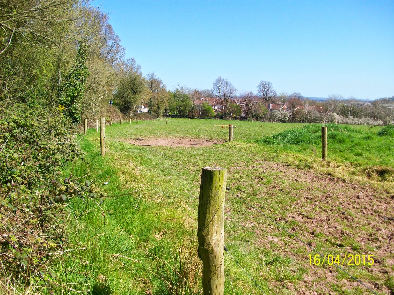
Hedge line back from Doughcloyne Bridge 
showing proposed Pedestrian Walkway


Streamlet flowing alongside Railway Embankment


 Concrete pipe under Railway 
Embankment near Fernwood Crescent


Close up of Concrete Pipe under Railway line


View Inside the Pipe!


 Billy O'Brien near Liberty Stream by 
Fernwood Crescent


 Southwards view of Liberty Stream on its 
downward journey from Corcoran's Bridge


Closer view of same shot


Short Video of Liberty Stream near 
Fernwood Crescent


Pondering on the use of artificial concrete pipes as opposed to organic cut stone Bridges the Group ended this part of the visit to the Liberty Stream. Ascending back up the field the Team approached the Fellowship House a.k.a. Philippine House. After a quick ramble around her gardens there was just time for a photo opportunity at the entrance to the old orchard , playground of many youths from the North during the Troubles when the house hosted them before the Peace Process deemed it unnecessary.


 Billy O'Brien by Orchard Walls at Philippine House


After walking from the Glasheen River to the Liberty Stream and taking in some of Togher's historic landmarks , it was decided to call it a day. An exciting foray into the past which is all the more important when the future most certainly holds many surprises which will change the landscape beyond all recognition. The group acknowledged that it is now more than ever , vitally important to archive as much of the region as possible before it is gone forever.

Sunday, April 5, 2015

13th Fieldwork Trip - 22nd March 2015 - Glasheen , Farmers Cross & Glenmore River

13 may be unlucky for some , but when it came to the Togher Historical Association's latest Fieldwork Trip , it proved extremely lucky in seeing the biggest attendance in close on 2 years - a total turnout of 6 - Kathleen O'Keeffe , Alex O'Keeffe ,  Eamonn Pearse , James O'Brien , Dan O'Riordan and Billy O'Brien. Unfortunately due to work and personal commitments others who had wished to participate were unable to attend. Ena Ronayne was given a special invite by the Blog but had to reschedule. So it was that the afternoon of Sunday 22nd March was given over to the 13th Fieldwork Trip undertaken to date by the Blog. A very clear agenda had been set out in advance : A return visit to the section of the Glasheen Stream between the Clashduv ( which is covered here ) and Deanrock bridges ; a first time call to the Airport Road region to investigate the Glenmore River and more besides and a look at the last of three original entrance points to Garrane Darragh House plus some other stop off points. More questions than answers presented themselves throughout the day , but the fun was in the chase and has laid the course for future trips to come.


 Clashduv Bridge post cleanup with improved flow


Close up view of old stone embankment


Alternate view of old stone embankment


First port of call was the Glasheen River or more properly the stretch which runs past Deanrock Estate  and flows under the Clashduv Road. This section of the stream was the subject of much debate in recent weeks with locals and Ex-Pats alike commenting on the acute build up of litter and debris which had been allowed accumulate to such an extent that it was blocking the flow of water. Quite aside from the health and safety aspects of this situation ; the overall ambiance of the waterway was sadly lacking and the consensus was that something needed to be done. Cllr. Fergal Dennehy came on board to instigate a clean up operation which saw great improvements. However , flood waters undid much of the work and as can be seen from the photos below , not all obstructions could be removed. One good thing from an historical perspective to come out of the revisit was the clearing back of much of the overhanging foliage on the banks which revealed a stone wall near the Clashduv  Bridge. This is under investigation by the Historical Association with two possible answers ; 1: It may well have been part of the sluice channel which existed in the old " Bog " now Clashduv Park or 2: It may be the remains of the " Rampart " which excited certain participants no end! Dan also commented on the signage on the wall of the Clashduv Bridge which is made up of a convoluted assortment of letters and numbers. Their significance is not known at this time. It should be noted here that a similar sign exists on the Woodhaven Bridge over by the South Ring Road area.


Alternate view of river under Glasheen Bridge


View of mysterious Bridge signage on opposite 
side of Clashduv Road near Clashduv Estate


Rarely seen pipe crossing on opposite side of 
Bridge running adjacent to Clashduv Estate


No visit or revisit to the Deanrock area is complete without a stop off to Devils Rock. The only surviving remnant of the Quarry , it was partially converted to an R.C. Grotto in 1988. Known as the " Citadel " in the 1950s , local myth has it , that the Corporation tried unsuccessfully to blow it up but had to give up after several attempts. Perhaps this is where its more well known moniker has its origins. To the left of the Grotto entrance are two deep drill holes. Speculation was rife as to whether they could have been drill charge holes from the aborted explosive exercise all those years ago. Billy O'Brien felt it would have been remiss of himself not to climb the rock after over 40 years!


 Rear left view of Devils Rock - Sheer climb


 Rear middle view of Devils Rock - Access climb


 Rear right view of Devils Rock - Hard climb


 Top view down of Devils Rock - well worn

 
 Billy O'Brien posing on Devils Rock 
- first time since the 1970s


 R.C. Commemorative plaque erected in 1988


 Front view of inserted R.C. Grotto with Statue


 View of Deanrock footbridge from Devils Rock


View of Clashduv Park from Devils Rock


Before the team departed , a walk through the Park was undertaken , with Dan O'Riordan  explaining to the group about recent work carried out to drain the Park with the use of underground pipes. Of course this lead naturally to the subject of the famous metal pipes which criss cross the Glasheen River by both Bridges , but more spectacularly by the Deanrock footbridge ( which is extensively documented elsewhere on the blog ). Whilst these are highly visible , it is the pipes under the Clashduv Bridge and opposite the road on its other side which are less so. Guesswork as to their usage range from electrical conduits to water-pipes to sewage pipes but the truth is still being searched for.


 Clashduv Park side of Glasheen River


 Clashduv Park side - banks foliage trimmed back


 Clashduv Park side - extensive clearance


Clashduv Park side - unknown masonry 
discovered in undergrowth


With the use of two cars , the Team formed a cortege and journeyed up to Lehenaghmore and its primary destination - the Farmers Cross region. One objective were to the fore ; to photograph the Lehenaghmore streamlet which emerges as a spring to the rear of the Airport and which also acts as the physical South Eastern boundary of Lehenaghmore/Togher. Firstly , a brief walkabout of the area was undertaken by all to ascertain the boundary close up at this location. At this point , James O'Brien and Dan O'Riordan departed having prior commitments elsewhere. Undeterred the remainder of the Team set off down the Airport Road in search of the southerly Lehenaghmore Boundary. Whilst satellite GPS and Mobile Google Maps had to be brought into use because of the uncertainty of the location , other exciting finds presented themselves in the form of a forked stream and an old stone Cottage , alas outside Togher's territory but highlighting the fact that a lot of natural and man made history can be found almost anywhere one cares to look. Back on track , the group had to make do with speed flash photography from a side open car window , due to the dangerous speeds encountered on this stretch of road. The boundary of Lehenaghmore showed itself in the form of a deep ridge flanked by a hill to its north with a spring stream flowing towards the road , and presumably under a bridge ( which needs further investigation ) and onwards and following a gradient away from Togher on its opposite road side.


Farmers Cross , Lehenaghmore


Right hand side of road leading off Farmers Cross 
showing marshy ground


Left hand side of road leading off Farmers Cross 
showing scrubland


Ditch line in background marking South Eastern 
boundary of Lehenaghmore , Togher


Close up view of ditch line boundary showing 
spring running eastwards towards Airport Road


The next destination proved to be the most exciting of all as the group pulled in towards the original route the " Airport Road " would have followed prior to its straightening back in the 1960s to facilitate traffic to the new flyway. Just before the turn off from the loop back onto the main road , it was decided to stop and search for a possible bridge. What was found astounded all present and literally took their breaths away. A bridge was indeed found , looking almost Tolkien in appearance , the huge stones having partially collapsed down on themselves , their sheer weight and closeness of join literally holding the whole structure in place! A spring at the base of the rocky enclave emanated from a fissure which had discolored the face of the boulders over which it passed. The Glenmore River was a mere trickle as it appeared from the right of this feature and meandered placidly through a sandy bed. The view was heart stopping as was the height of the bank - between 40 and 60 feet down to the bottom. The slope was constituted of very fine soil which made it impossible to descend for a closer inspection. The opposite side of the road afforded a better view and also gave a good impression of the scale of the depression the River made , with the land more uneven at this juncture. A man made V-shaped structure lay at the bottom right hand side whose purpose is at present unknown. It was speculated that it could be another spring or water outlet. The purpose of the Bridge itself posed many questions , not least the difficult task of erecting it in the first place. The reason for its construction lent itself to the notion of an important access point at this part of the old road back in the 17th to 19th Centuries - crossing from Lehenaghmore into Ballycurreen and vice versa. It is impossible for the camera lens to accurately translate what the human eye can perceive as is the feeling of depth perception , but it is hoped that the photos give some clue as to what was experienced on the day. The Team then set off back down the Airport Road , paying homage to the Mass Rock , which is partially covered over by trees and vegetation on the opposite side of the road. It is thought that a cross was carved into the stone in the 1950s by an American returning home to mark the spot for posterity. Even though it lays outside Togher's boundary , it was intriguing to say the least and something for other local History Groups to investigate further.


Old stone Bridge off Airport Road 
near modern Pegasus Sculpture


Video showing old Stone Bridge 
and deep floor bed of Glenmore River


Video showing opposite side of Glenmore River 
as it rapidly descends down a steep gradient 
towards Pouladuff Crossroads , Togher


Zoom shot of spring near old Stone Bridge


Billy O'Brien on slopes of Glenmore River


Zoom shot of V-shaped water outlet on 
opposite side of old Stone Bridge


View of deep gulley opposite 
side of old Stone Bridge


As a closing statement on the last of the 3 original entrance points of the old Garrane Darragh Big House the group next stopped off momentarily at the entrance to a now private enclosure at the junction of Sarsfield Road and Togher Road ( Doughcloyne Hill ). The original roadway would have passed through here , with a high embankment to its left ( still very much in evidence ) and carried on through to the site of the present day Mormon Church and looped up and to the left of Eagle Valley and Togher Reservoir before stopping on the brow of the hill overlooking the Big House. Although 2 structures are shown to the left of the entrance on 19th Century OSi maps , it is thought they were not Lodges but rather workmens Cottages ; alas they are gone as well , supplanted by a modern Industrial Estate.


 Remnant of original Togher Road entrance to 
Garrane Darragh House off  Sarsfield Road


Opposite side of high tree lined embankment 
of original roadway to Garrane Darragh House 
from Togher Road


Kathleen O'Keeffe suggested that the Team visit a site clearance on Doughcloyne Hill before calling it a day. Previously hidden from view by considerable coverage of trees and vegetation the clearing back revealed a house. It is thought it may date back to the 1920s or 1930s. Speculation ensued as to whether this house would soon be demolished to make way for a new build. Eamonn Pearse departed at this juncture but it was decided by the remainder of the group to pay a visit to Woodhaven as Billy O'Brien was absent from the last FieldworkTrip to this particular spot.


 Old Cottage uncovered after major tree 
clearance on Doughcloyne Hill


 Billy O'Brien near iron wrought gates


 Billy O'Brien taking shelter behind pillar trying 
to capture photographs in very sunny conditions


Although heavily photographed previously , it was decided to video the Bridge and Glasheen River at Woodhaven to bring it to life on the blog. At this stage , it was decided to wrap things up and digest all that had been seen throughout the afternoons travels. The end of another fantastic jaunt around Togher.


Glasheen River in Woodhaven Estate , Togher