Showing posts with label Culvert. Show all posts

Saturday, February 19, 2022

33rd Fieldwork Trip - 16th February 2022 - Culverts , Bridges & Progress

On Wednesday , 16th February 2022 , Togher Historical Association took to the road for the first time since September of 2021 to record the progress of the ongoing culvert works on Togher Road.  The immediate and stark changes which presented themselves was the filling in of the Gully by Greenwood Estate next to the Garage and the removal of the old stone wall completely. ( There is a raised surface now present which may accommodate street furniture and a lower hardcore base for a new pedestrian walkway ). Coupled with that was the culverting of the section of stream by Togher Cross and the disappearance of the old beveled stone wall and the cutting down of the trees which lined its banks. The last two sections of stream to remain daylighted since the 1840s was now erased from history and from sight. Liberty Stream a.k.a. Togher Stream is now no longer visible from Togher Cross to Coffey's Field. The New Culvert which has its beginnings alongside the old Southern Fruit Industrial Estate is a mind blowing 4 Metres Wide by 4 Metres Deep and follows a largely linear trajectory from Togher Cross to the Community Centre where it makes a sharp turn to run along Coffey's Field. The section of New Culvert by Southern Fruit is still under construction and will alter the original Stream's flow there into the concrete channel which also has an overflow culvert to cater for sudden rises in water.


Old gully filled in near Garage
( looking North towards Greenwood Estate )


Old Gully across from School
( Looking back towards Garage )
 
 
Looking towards Togher Cross
( Lanes old cottage on corner )


View of Lanes cottage and garage
( Lehenaghmore Road side )


Side view of Lanes cottage and Garage
( Looking back from Lehenaghmore Road to Togher Cross )


Close up view of Lanes garage and covered stream


Alternate view of Lanes cottage and Garage
( Lehenaghmore Road looking towards Togher Cross )


Close up view of Lanes cottage


Location of New Culvert by Southern Fruit


Original Togher Stream next to Southern Fruit
( To be culverted into new concrete channel - see next photo )


Culvert section under construction next to Southern Fruit
( Overflow channel on right )


Interior shot of Overflow Channel


1980s Pipes next to Southern Fruit
( Originally daylighted near stream on Togher Cross )


The group next made its way to the rear of SuperValu for a look at a piece of hisstory hidden in plain sight. The area on view in the photos was once known as Minnie's Orchard and existed right up to the 1960s when the road facing walls were demolished to make way for the then new Togher Shopping Centre in 1968. The surviving walls are encircled by Earlwood Estate which was built between 1958 and 1962.


Original stone wall to rear of SuperValu


Old stone wall to rear of Earlwood Estate


A spot check was made on some of Togher's remaining historical houses on Togher Road and Pouladuff Road. First on the list was a visit to the two storey semi-detached house on Ardmanning Hill which features in the famous harvest photograph from the 1950s. Research is still ongoing with it presently being thought to be Russell's dairy farm. However this has not conclusively been determined. Pouladuff Road beckoned for a brief look at 3 houses which stood before any modern development pre-1960s. The Laurels which is currently for sale with rumours that it is to be demolished to make way for new builds. The house is over 200 years old and is in private ownership. Next on the right hand side past Edward Walsh Road moving south was Bellvue House , an old two storey build and finally an old cottage. Research again is underway to unearth their past.


Russell's Dairy Farm? Ardmanning Hill


The Laurels , Pouladuff Road


Bellvue House , Pouladuff Road


Old cottage , Pouladuff Road


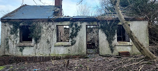
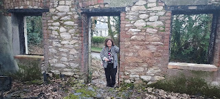
Next stop was a visit up Lehenagh Beg to look at the old Kelly's cottage. The site has been sold and plans are underway to build 16 new houses. The old once more makes way for the new. Evidence that not only is Togher changing , but that it is changing beyond all recognition.


Planning application near roadside


Front view of cottage


Kathleen O'Keeffe , Togher Historical Association


Land to rear to consist of 16 new dwellings

Final visit of the day was to the old railway bridge in Mahers Lane. Hard to believe that trains once ran under it and even harder to believe that it was the first time the group had looked at it. Even harder to believe is the fact that Togher still has 5 railway bridges intact! All part of the old Cork Bandon line. These will be covered in a future article.


Maher's Lane railway bridge
( uphill from Maher's Lane )


Mahers railway bridge looking back towards St James Cemetery


Close up view of Mahers Lane bridge

Saturday, September 25, 2021

32nd Fieldwork Trip - 25th September 2021 - Kilmurriheen & Togher Culvert

On 25th September 2021 , Togher Historical Association traveled to the Townland of Kilmurriheen to meet with local Oran O'Connell to learn about the local history of Togher's southernmost region. Lying in the R.C. Parish of Ballinhassig , the area nonetheless identifies as Togher with provenance being provided by the natives of the Townland. Kilmurriheen has one short through road which begins at Liberty Bridge and ends at Peggitty's Cross. The land stretches on one side right down to the Bandon Road ( just after Maxol garage ) and on the other to Knockalisheen. The group began their journey with Oran acting as guide throughout at Liberty Bridge which is listed on old OSi maps and one of the few named bridges in the Togher district as a whole. The stream which also takes the name of Liberty ( not to be confused with the Liberty stream which flows under Corcoran's Bridge ) rises not far from the bridge and flows under a specially constructed arched brick wall adjoined to the residence of the Neff family.


Liberty bridge at Kilmurriheen


Side view of bridge with Liberty stream


Arched brick wall of Neff family to rear of Liberty stream
 
 
The team then made their way to the end of the Townland at Peggity's Cross. Here they saw the now disused " Flapper " track used by coursing clubs back in the 1960s and 1970s. A Flapper track was an unofficial training ground which was used to test the speeds of dogs. The sheds in which the dogs were kept are still intact though the soft boggy ground in front of them is now heavily overgrown. Oran explained that further up the road there used to be a gate into the field. Contact was made with local Denis Bradfield who once worked for the Ordnance Survey. He explained that although the Townland was in a different Parish , it was was still very much part of Togher.


Peggity's Cross , Kilmurriheen as seen from outside Townland


Dog sheds as seen from roadside


Alternate view of dog sheds
 
 
Kathleen O'Keeffe
Togher Historical Association
Peggity's Cross , Kilmurriheen
 
 
Oran took the team through a whistlestop tour of the locality name checking all the landowners and residents in the Townland and even beyond. The townland was divided up on the left hand side moving away from Peggity's Cross towards Liberty Bridge between the O'Briens and the O'Learys. Land on the opposite side was partially owned by O'Carroll and Kingstons. He recalls working during the summer as a youth for a local farmer where he would assist in the daily milking of up to 400 dairy cows. He explained that his family originally hailed from Barracks St. until they moved to Greenwood Estate in 1980 for a short time before moving to Kilmurriheen in the mid 1980s. Several milk churn concrete rests were pointed out along the way. Oran explained that dairy farmers would use these to load and offload the heavy milk churns from carts and later lorries.


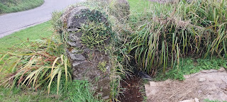
Milk churn rest in Kilmurriheen


Milk churn rest hidden in ditch


Oran explained that there was a group of 7 cottages built on private plots grouped together on the eastern side of the Townland all built between the mid 1970s and 1980s. His Parents still reside there. The rest of the various houses peppered around the Townland are the siblings of the various local Farmers. The team made a final stop off once more at Liberty Bridge. Here Oran mentioned that the old cottage was used as a stables/storeroom by the Kingstons who are renowned Holstein Cattle breeders. Another surprising discovery was made later on as the group moved away from Kilmurriheen when a house fronting onto the road displayed the title of a Townland - Gortagoulane! The only known instance of a Townland title being displayed on a house.

 
Old Kingston cottage near Liberty Bridge
 

Gortagoulane signage on house


The group eventually made their way to Togher Road to quickly take in the progress being made on the Culvert. Of particular interest was the gully near Greenwood Estate. The stream bed was now completely dry and devoid of water for the first time since the 1840s. An opportunity not to be missed presented itself with a surreal walk through of the gully. It is thought that there are plans to completely infill the dry gully which will see the arched bridge disappear underground forever never to be seen again. Another old bridge near the Community Centre has now been irretrievably lost. 2 videos shown below display the gully in its dry state and will in time become important historical mementos of a bygone age.


Culvert under construction towards Togher Cross
 
 
View of dry gully from entrance to Greenwood Est.

 
View of dry gully from Togher Road


Inside the gully looking back to the overhang slab
 
 
Inside the gully looking towards the arched bridge


Video inside the gully of the arched stone bridge
 
 
Video inside the gully showing the concrete overhang 

Monday, July 13, 2015

Culvert Works In Progress Report- July 2015 - Ongoing

Floods have been a major part of Togher's history not only in times past ( see photo below ) but in more recent times as well. It has historically been proven that the Liberty Stream's natural floodplain lay near the now defunct Southern Fruit warehouse the owners of whom campaigned in the 1970s to have the watercourse piped at that location which it can be argued exacerbated the situation by moving the problem downstream. To hopefully offset this natural event from reoccurring or at best containing it , Cork County Council has commissioned works to begin on installing a new Culvert to compliment the already existing one by Coffey's Field which was built in the late 1980s. Works are commencing at a rapid pace with plans to install new larger pipes under the main road running adjacent to the Church and Schools. As a temporary measure to offset unexpected flooding the Blog has been informed that the block wall by Griffins Pianos will be removed and a railing erected to facilitate overflow of flood water should the need arise. The original stone wall by the Gulley near Greenwood Estate has surprisingly had its mid section removed and reconstituted atop the remaining left and right parts with a railing soon to be fitted , again mimicking the purpose allegedly ascribed to the similar one across from the Community Centre. The Historical Association has engaged with County Council vis-à-vis the protection of this archaic structure. This is ongoing with the helpful assistance of several local Councillors but the situation at present seems to be that the wall will eventually be completely removed!


Flooding near Muintir na Tire 1947

The Blog would like to thank various members of the public for taking 11th Hour photos of the works both at night and during daylight as they proceed at an alarming rate of knots. Whilst preventative measures regarding future events of flooding are to be welcomed , it is hoped that some compromise can be reached which will please all parties. Future updates will be posted as and when they become available. 


 Night-time shot of old Gulley Wall with
 mid section removed for installation of railing


Railing installed near Griffins Piano shop


 Original stone wall reconstituted to form break


 New footpath laid down with supports in place


 Close up of original stone reconstituted 
with new mortar atop existing wall


 Long shot of Gulley works in progress


 Long shot of footpath and broken wall


 Close up of Gulley gap


 View of new speed ramp entrance


14th July 2015:
Update on work in progress near Greenwood Estate - Photographs courtesy of Kathleen O'Keeffe. The photos show the new railings in place near the gulley and a new painted speed ramp at the entrance to Greenwood Estate. Many more changes are envisaged and a fear by the Historical Association is that the wall by the stream at Togher Cross could suffer interference now as well in the not too distant future. Quite why the contractors would be installing a speed ramp is bizarre to say the least as this work is normally the preserve of the Council and the Culvert Works were supposed to be let out to tender.


 New railings in situ at gulley


New speed ramp installed
at Greenwood Estate


17th July 2015:
Eamonn Pearse submitted the following photographs of completed interim works near the Gulley by Greenwood Estate. A series of road side drains run alongside the new footpath directly adjacent to the new railings with a shot showing a plastic feeder pipe running off from one of them into the Gulley.


Eamonn's retro sepia shot of the new railings


 Road drains adjacent to Gulley


Plastic feeder pipe into Gulley