Thursday, June 9, 2022

Townlands - 14/15 - Knockalisheen

 Cnoc an Lisín - Hill of the Little Fort - 226 Acres

Knockalisheen - ( Data from Townlands.ie )

In 1586 the Townland is listed as Knocknyleyshyne. The " small fort " in the title was alluded to by a patch of land known as the " Fort Field ". Extensive agriculture has all but obliterated this ancient dwelling. One of only two to have been specifically identified in Togher though there may be more. The 1911 Census identifies an Alexander Morrison , a Presbyterian bachelor who lived with his sister Margaret. Evidently , the heavy vegetation and incline through which the Glasheen River flows bears his name , Morrison's Ravine. Other families present in the Townland at that time were the Leahys , Bohanes and Coakleys.

Remains of Water Pump at Lios Cross


Glasheen River approaching Morrisons Ravine


Knockalisheen is an agricultural hinterland of Togher which is bisected by the Glasheen River. It also has one of only two remnants of water pumps left in Togher , albeit with no pump and just the concrete platform remaining at Lios Cross. Internal names include the aforementioned Morrison's Ravine and Lios Cross a.k.a. Crossnacroha which it shares with 2 other townlands , Doughcloyne and Knocknamallavoge. The townland is also well known for breeding holstein cattle as shown in the beautiful " Togher Holsteins " sign shown below.

Holstein farm proudly displaying its location

Addresses ( Modern Era )

Lios Cross
Spur Hill

Addresses/Structures ( Historical Era )

**Research Ongoing...

Water Pump ( Lios Cross )
Lios Cross a.k.a. Crossnacroha
Spur Hill
Morrisons Ravine
Glasheen River

Boundary ( Shown in red on aerial map )

Starting at Lios Cross and moving down the right side of Spur Hill to the bridge under which the Glasheen River flows ; than following the Glasheen River through Morrison's Ravine where it is joined by another stream before meandering its way back up to Spur Hill before turning before Liberty Bridge and through the farm cross country to join up with the left side of Spur Hill all the way back to Lios Cross at the point started from.

Knockalisheen - Aerial Map

Thursday, May 12, 2022

Townlands - 13/15 - Knocknamallavoge

Cnoc na Mealbhóg - Hill of the Leather Bag - 181 Acres

Knocknamallavoge - 19th Century Map

In 1301 it is known as Cnokkenemalevok. Quite how it acquired its leather bag title is a mystery and lost to the mists of time. Perhaps most famous for being the site of a castle about which nothing is known of or its inhabitants. 19th Century maps simply refer to it as " in ruins " or " site of " meaning it may have been demolished long before then. Following the Cromwellian Confiscations of the 1650s the Townland came under the ownership of the Piggotts. The Tithe Applotment Books of 1823-37 show Regan and Duneen as principal residents. The 1911 Census shows the Corcoran and Coakley families as residents of the Townland. Ordnance Survey of 19th Century alters the northern boundary and aligns it with the top half of Mahers Lane. The blog will refer back to the original boundary as de facto.


19th Century OSi Map
showing site of Castle


1911 Census - Corcoran family

The 1911 Census as shown above relates to one family in Knocknamallavoge - the Corcorans. Michael Corcoran is 60 while his wife Julia is only 36 and both speak Irish and English. Interestingly their children Denis aged 5 and Margaret aged 3 were born in America , so it would seem likely Michael made his fortune in the U.S. , met his future wife while there who was also an immigrant and came back to Ireland to purchase land to raise his new family.


Tithe Applotment Book 1823-37
Regan and Duneen residents


The townland is predominantly agricultural with the Glasheen River acting as its natural southern and western boundary with a narrow internal stream emanating from a spring which flows out of the Townland to neighboring Chetwynd to join up with the Glasheen River. Part of its eastern boundary mates with Lios Cross ( where Toghers 2nd only remnant of water pumps - platform only - is sited nearby on the Knockalisheen boundary ).

Addresses ( Modern Era )


**Research Ongoing


Addresses/Structures ( Historical Era )


Castle
Viaduct View ( Farm )
Morrisons

Lios Cross


Boundary

Starting at a point on Spur Hill adjacent to the Ring Fort and moving south to take the right turn at Lios Cross near the old water pump platform and onwards to the stile gate at Morrisons Ravine. Following the Glasheen River down towards Waterfall and following the course of the Glasheen River as it flows northwards on the right side of the Bandon Road to turn at a point adjacent to the Ring Fort and cross country in a straight line to the point started on Spur Hill.

Knocknamallavoge - Aerial Map


Saturday, April 16, 2022

The Hegartys of The Laurels - Official Book Launch - April 7th 2022

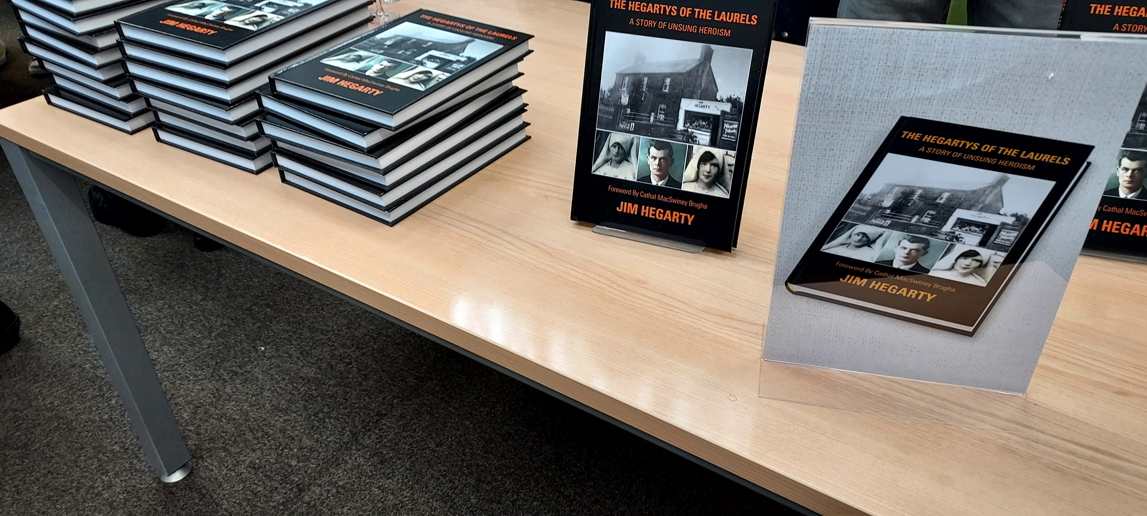
The Hegartys Of The Laurels book cover


Jim , Anne , Pauline , Eileen & Jack Hegarty
outside The Laurels 2022


On Thursday evening on April 7th 2022 , the Official book launch of " The Hegartys of The Laurels " by Jim Hegarty took place at Cork City Library on the Grand Parade. By personal invitation of Jim Hegarty , the Togher Historical Association turned up to archive the entire event. A great turnout by Togher was very much in evidence as Tidy Towns and Community Association also gave their support. Following is a fantastic showcase of photos and videos of the nights proceedings.


Act 1 Military re-enactment members
 
 
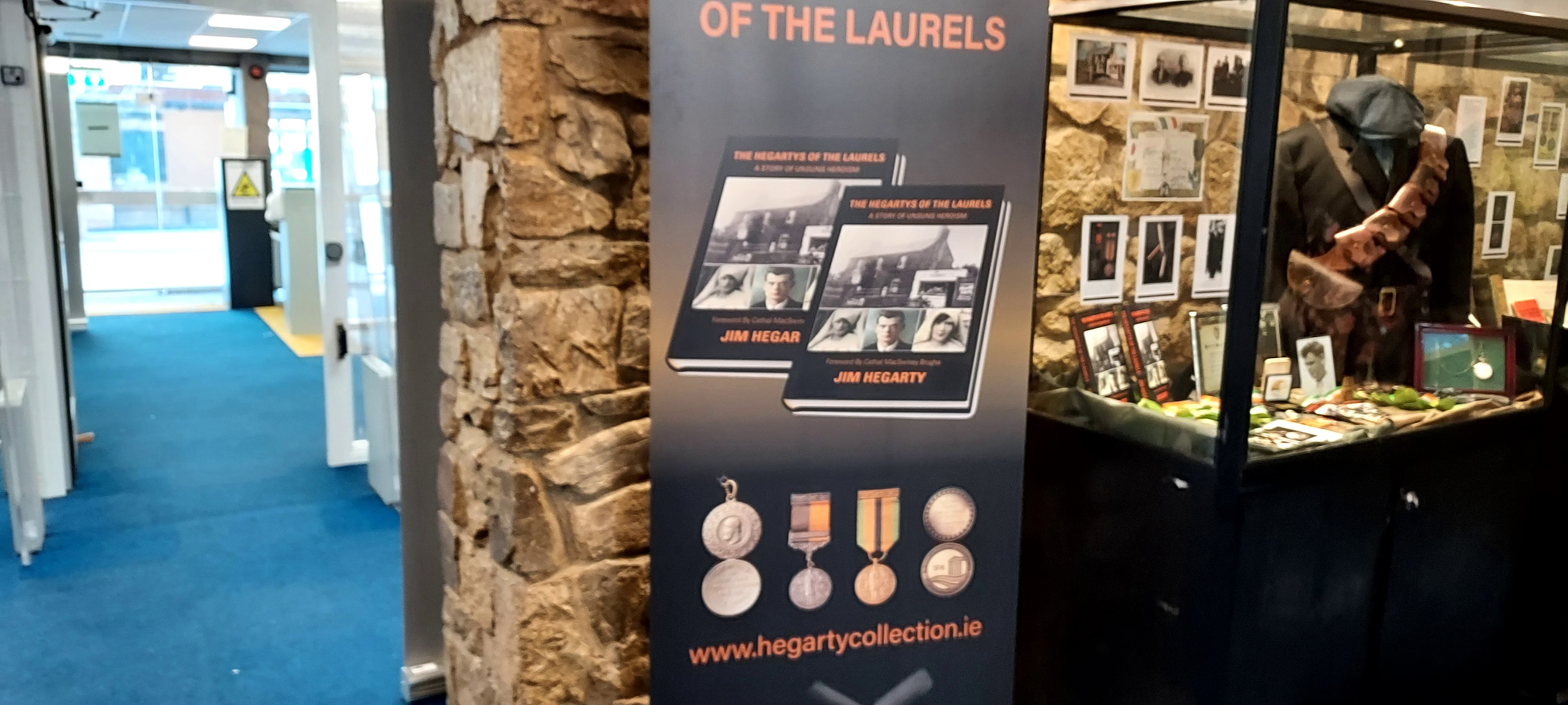
Visitors to the event were treated to an extravaganza of War Of Independence memorabilia from the front door to the main hall. Members of Act 1 reenacted Irish Citizen Army soldiers ( with their trademark Slouch hat and white linen kit bag ) and Irish Volunteers sporting bandoliers ( shown above ). The foyer was laid out with enclosed glass cabinet displays detailing the archives of John Joe Hegarty and his two sisters Mamie Forde and Nan Fennell including a display dedicated to Joe Murphy who served under John Joe Hegarty in H Company.


Book launch stand at entrance to foyer
 
 
Display showing John Joe Hegarty's memoribilia
and the uniform he would have worn while in action


John Joe Hegarty's medals and awards
 
 
Mamie Fordes display showing her Wedding Dress
worn in the Lough Church in 1920


Mamie Fordes marriage certificate 
and photo showing her sister Nan as bridesmaid
 
 
Joe Murphy's display cabinet
 

The main hall of the Library was given over to the evenings event with a stall serving refreshments to the right and a table laden with the new books for sale to those present. The left side of the room was decked out with seating for members of the Hegarty clan and invited members of the public. Facing this was the speaking podium with banner stands in the background showcasing Togher Tidy Towns , The Hegartys of The Laurels and Togher Historical Association. Before the evening started , Billy O'Brien and Kathleen O'Keeffe touched base with Jim and his sisters Ann and Pauline. Fergal O'Connor of Togher Tidy Towns also touched base to discuss ongoing projects which the Historical Association are involved in. These include plans to build a replica well near Togher Cross and the recent developments around a Peace Park dedicated to the Hegarty sisters in Clashduv Park.


The Hegartys of The Laurels book stand

 
Adam Duggan and Act 1 Military procession
with Lord Mayor & Jim Hegarty


The hall was soon packed out and the event commenced with Adam Duggan piping in the Volunteer actors followed by Lord Mayor Colm Kelleher and Jim Hegarty. Lord Mayor Colm Kelleher gave the opening speech remarking on the huge turnout despite the event not being publicised. Jim Hegarty then gave his introductory speech on the background to the book and his Father and Aunts involvement in the War of Independence and Civil War. Togher Historical Association made a special presentation of a placue to Jim Hegarty in honour of his Father , John Joe Hegarty ( see below ). The event closed with photoshoots which saw everybody from former T.D.s and Lords Mayor ( John Dennehy - Togher's only Lord Mayor to date ) to the Bishop of Cork! Such was the importance placed on this event , that the Togher Community Association cancelled their meeting to attend the book launch. All relations of the Hegarty , Forde and Fennel clan were present to celebrate their families legacy and lineage.

 
Lord Mayor Colm Kelleher opening speech


Jim Hegarty speech at City Library
 
 
Kathleen O'Keeffe - Togher Historical Association
with Anne O'Driscoll ( nee Hegarty )


Jim Hegarty , Lord Mayor Colm Kelleher & Bishop Buckley
 
 
Placue presentation by Togher Historical Association

 
Jim Hegarty's family with Bishop Buckley 
and Lord Mayor Colm Kelleher


Members of Forde and Fennell family 
with former Lord Mayor John Dennehy seated centre


Lord Mayor Colm Kelleher , Kathleen O'Keeffe & Billy O'Brien
 - Togher Historical Association , Fergal Dennhey
 -  Togher Community Association & Jim Hegarty


Gus Fennell ( Nan Fennell's son ) 
& Jack Hegarty ( John Joe Hegarty's son )
 
 
Shirley Kelleher ( Joe Murphy's grand niece ) & Jim Hegarty


Jim Hegarty & Helen Van Lakem ( nee Carroll )
Andalucia , Spain 13th May 2022


Eileen , Pauline , Lord Mayor Colm Kelleher , 
Jim , Jack & Anne at Book Launch

Friday, April 15, 2022

Togher Learning Neighbourhood Expo - St. Finbarrs H.F. Club - April 6th 2022

On April 6th 2022 , the Barrs club hosted the Togher Learning Neighbourhood Expo. The event was opened by Cllr. Fergal Dennehy deputising for the Lord Mayor who welcomed all present. The event began with pupils from Togher Girls National School singing a multi lingual song in acknowledgement of the many Nationalities now studying at the school. Next up was a presentation to people of all ages including local legends Donie Og and John Dennehy in recognition of their community activism.

Togher Learning Expo leaflet


Togher Learning Neighbourhood stand


Fergal Dennehy addressing the Expo at the Barrs


The purpose of the Expo was to highlight the various local groups within Togher which included sports , education and historical interests. Togher Historical Association was represented by Kathleen O'Keeffe and Billy O'Brien and the stall attracted much attention. The table was covered with many rare photos from Toghers past including albums for people to browse through at their leisure. Former Barrs player Jim Hegarty paid a visit prior to his book launch the following night. John Dennehy also dropped by to offer his continuing support.

Jim Hegarty - former Barrs player


 Billy O'Brien & John Dennehy
 
 
Fergal Dennehy & Kathleen O'Keeffe


Togher Historical Association table


A quickstop tour was made of other stands which included most of the sporting clubs around Togher and the local primary schools and many others. Below are photos of each stand. Many thanks to all the organisations who turned up to promote Togher as a hotbed of activity for youngsters and matures alike.

Everton F.C est'd. 1958


L'Arche Community


Togher Community Association


Mrs. Manning and colleague


Togher Boys National School


Togher Athletics Club


Togher Boxing club


Togher Family Centre


Cork City Partnership

Friday, March 11, 2022

Townlands - 12/15 - Gortagoulane

 Gort an Ghabhláin - Field of the Fork - 401 Acres


Gortagoulane - ( Data from Townlands.ie )


Gortagoulane is thought to have been the seat of the Ui Mc Ceir tribe up to their eventual loss of power in the late 1100s. The fork in its title refers to the various streams which virtually encompass the land ; the Liberty stream which rises at its south eastern tip and flows under Corcoran's Bridge ( built by journeymen masons in the 18th Century and named after the farmers who commissioned its construction ) in a northerly direction meeting up with a winterborne stream which rises near its western boundary and an internal stream which rises inside its territory. The Glasheen River acts as its southern boundary with Doughcloyne making up its western boundary. The land to its extreme north is marsh or bogland and a possible fulacht fiadh ( ancient pit which was used for dyeing , bathing and brewing ) is located on its land where the Gortagoulane stream and the Liberty stream meet.


Remains of old Ashgrove Farm


Gortagoulane stream meets Liberty stream
( Probable site of Fulacht Fiadh )
 

Derelict houses ( bought by Cork Airport ) near Corcorans
Bridge ( Possibly dwellings of Corcoran Brothers? )

There are 2 old houses named Ashgrove House and Ashgrove respectively which appear on 19th Century maps and are farmsteads. Another older residence once existed inland and which was accessed via a long laneway from Lehenaghmore before encountering a lodge ; this was Ashgrove Farm and all that remains of the structure are two right angled high stone walls. The land today houses Richardsons farm which is accessed from Doughcloyne and some private dwellings. In 1911 Census there was a total of only 8 inhabited houses in the entire Townland. Gortagoulane has two internal roads , Matthews Hill ( which emerges from Lehenaghmore and bisects the Townland as it exits ) and Wilson's Lane ( Ashgrove Close ) a.k.a. Ben Deebles Lane. The Townland's south eastern portion takes in part of the runway of Cork Airport.

Corcorans Bridge

Addresses ( Modern Era )

Wilson's Lane
Ashgrove Close
Matthews Hill
Ashgrove House ( Farm )
Ashgrove ( Farm )


Addresses/Structures ( Historical Era )

Fulacht Fiadh
Ashgrove House ( 2 walls remaining )
Corcoran's Bridge

Boundary

From a point near the airport following the Liberty Stream in a northerly direction under Corcorans Bridge to meet with the Gortagoulane Stream and following the direction of the old winterborne stream westwards in a meandering manner southwards until the access road/lodge into Richardsons Farm before moving southwards again to Wilsons Lane before joining the Glasheen River a little further on and tracing the stream all the way back to the Airport where it rises near the Liberty Stream.