On 25th September 2021 , Togher Historical Association traveled to the Townland of Kilmurriheen to meet with local Oran O'Connell to learn about the local history of Togher's southernmost region. Lying in the R.C. Parish of Ballinhassig , the area nonetheless identifies as Togher with provenance being provided by the natives of the Townland. Kilmurriheen has one short through road which begins at Liberty Bridge and ends at Peggitty's Cross. The land stretches on one side right down to the Bandon Road ( just after Maxol garage ) and on the other to Knockalisheen. The group began their journey with Oran acting as guide throughout at Liberty Bridge which is listed on old OSi maps and one of the few named bridges in the Togher district as a whole. The stream which also takes the name of Liberty ( not to be confused with the Liberty stream which flows under Corcoran's Bridge ) rises not far from the bridge and flows under a specially constructed arched brick wall adjoined to the residence of the Neff family.
Liberty bridge at Kilmurriheen
Side view of bridge with Liberty stream
Arched brick wall of Neff family to rear of Liberty stream
The team then made their way to the end of the Townland at Peggity's Cross. Here they saw the now disused " Flapper " track used by coursing clubs back in the 1960s and 1970s. A Flapper track was an unofficial training ground which was used to test the speeds of dogs. The sheds in which the dogs were kept are still intact though the soft boggy ground in front of them is now heavily overgrown. Oran explained that further up the road there used to be a gate into the field. Contact was made with local Denis Bradfield who once worked for the Ordnance Survey. He explained that although the Townland was in a different Parish , it was was still very much part of Togher.
Peggity's Cross , Kilmurriheen as seen from outside Townland
Dog sheds as seen from roadside
Alternate view of dog sheds
Kathleen O'Keeffe Togher Historical Association Peggity's Cross , Kilmurriheen
Oran took the team through a whistlestop tour of the locality name checking all the landowners and residents in the Townland and even beyond. The townland was divided up on the left hand side moving away from Peggity's Cross towards Liberty Bridge between the O'Briens and the O'Learys. Land on the opposite side was partially owned by O'Carroll and Kingstons. He recalls working during the summer as a youth for a local farmer where he would assist in the daily milking of up to 400 dairy cows. He explained that his family originally hailed from Barracks St. until they moved to Greenwood Estate in 1980 for a short time before moving to Kilmurriheen in the mid 1980s. Several milk churn concrete rests were pointed out along the way. Oran explained that dairy farmers would use these to load and offload the heavy milk churns from carts and later lorries.
Milk churn rest in Kilmurriheen
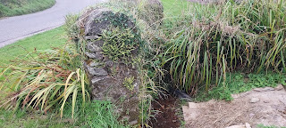
Milk churn rest hidden in ditch
Oran explained that there was a group of 7 cottages built on private plots grouped together on the eastern side of the Townland all built between the mid 1970s and 1980s. His Parents still reside there. The rest of the various houses peppered around the Townland are the siblings of the various local Farmers. The team made a final stop off once more at Liberty Bridge. Here Oran mentioned that the old cottage was used as a stables/storeroom by the Kingstons who are renowned Holstein Cattle breeders. Another surprising discovery was made later on as the group moved away from Kilmurriheen when a house fronting onto the road displayed the title of a Townland - Gortagoulane! The only known instance of a Townland title being displayed on a house.
Old Kingston cottage near Liberty Bridge
Gortagoulane signage on house
The group eventually made their way to Togher Road to quickly take in the progress being made on the Culvert. Of particular interest was the gully near Greenwood Estate. The stream bed was now completely dry and devoid of water for the first time since the 1840s. An opportunity not to be missed presented itself with a surreal walk through of the gully. It is thought that there are plans to completely infill the dry gully which will see the arched bridge disappear underground forever never to be seen again. Another old bridge near the Community Centre has now been irretrievably lost. 2 videos shown below display the gully in its dry state and will in time become important historical mementos of a bygone age.
Culvert under construction towards Togher Cross
View of dry gully from entrance to Greenwood Est.
View of dry gully from Togher Road
Inside the gully looking back to the overhang slab
Inside the gully looking towards the arched bridge
Video inside the gully of the arched stone bridge
Video inside the gully showing the concrete overhang
Leitheanach Mór - Wide Open Space - 1025 Acres a.k.a. Big Meadow
Lehenaghmore - ( Data from Townlands.ie )
Coming in at well over a 1000 acres , Lehenaghmore is by far the largest of all the Townlands in Togher. Like its smaller sibling , Lehenagh Beg , its name is a convolution of misspelling and guesswork based on an incorrect anglization of the original Irish. Suffice it to say , it like its neighbour Lehenagh Beg , is a meadow , albeit , a larger variety. Historically , the Townland was owned by Milo de Cogan in 1177. By
the time of the Cromwellian Confiscations of 1656 it was in the hands of
George Gould ; following confiscation it passed to James Duke of York. In modern times , the Townland is most famous for being home to Cork Airport. It is also at 547ft the highest point in Togher and overlays a gigantic aquifer which feeds multiple streams issuing in all directions , the better known being the Glenmore , Liberty and Glasheen streams.
Corcorans Bridge
Historical interior names included Cumar na dTrí na nUisce ( the meeting of the three waters ) , three springs which go to form the Liberty stream a.k.a. Togher stream which flows under Corcorans Bridge and down to Togher Cross ; Cros na Gol ( the place of skulls ) , which was situated at the junction of Mathews Hill and Lehenaghmore Hill and from where funerals were followed on foot to the old graveyard below. It is believed an old Norman church existed next to the graveyard. Following development in later years cut limestone blocks were found but sadly removed from the site. During the Penal Laws of the 18th and 19th Centuries it was also known as Cros na Scoil owing to a hedge school being located there ; and Kilmahonach ( market town ) which during the 12th and 13th Centuries acted as a place of commerce before entering the City and which even minted its own coins. Big house names and lodges included Lehenaghmore House , Lehenagh House ( home of the brother of Fr. Mathew - see photo below ) ; Cruiskeen Lodge , Carrig Lodge , Cúl Álainn ( Coolallen ) and the Teampaleen ( an old graveyard adjacent to Norman church ). The Cork Bandon railway line once ran through the Townland with only a sole remaining bridge as a testament to its past. Agricultural land is now sandwiched between the built up region of the North and the Airport to the South. The section of road between Togher Cross and the old railway bridge has also been the educational hub of Togher since 1851 with the old cottage school ( demolished 1990s ) and the now Togher Community Centre ( Boys/Girls school 1891 - 1971 ) , Togher Girls School 1961 ( now Foróige/Togher A.C. ) and Togher Boys and Girls schools ( opened 1971 ). An honourable mention must be made of the Muintir na Tire who provided sterling support to the local community for many years. It was also during the 1980s home to the Doughcloyne Inn later Hotel ( now O'Connell Court retirement home ). Before the advent of dancehalls in the 1960s , platform dancing was a feature of Togher , and Togher Cross was the usual location for this form of entertainment. So from ancient medieval towns to old churches and graveyards and numerous schools , Lehenaghmore can lay claim to all. One other ghost from the past occupies the eastern side of Woulfe Lane and that is the remains of the Cottages and carriage houses of the old Lehenagh House which although thankfully still extant are in a ruinous state.
Fr. Matthew 1851
( Brother hailed from Togher )
Addresses ( Modern Era )
Togher Community Centre Togher National Schools Togher R.C. Church Robinscourt ( portion of ) O'Connell Court Retirement Home Whytes Centra Togher Cross Greenwood Estate Palmbury Estate Palmbury Orchard Applegreen Service Station VariousPrivate builds along Togher Road Lehenaghmore Industrial Estate Ashbrook Heights Aisling Close Alderbrook Fernwood Crescent Chestnut Drive Lehenaghmore Park East Avenue West Avenue The Mews Laurel Lane Brook Lane Westgate Business Park Various private builds along Mathew Hill Manor Road Saint Ambrose The Gates The Drive The Lawn Hill Lane North Avenue South Avenue Ardross Wolfe Avenue Cookellure Lawn Cookellure Rise Cookellure Way Cookellure Lane Cookellure Grove Cookellure Avenue Cookellure Road The Hamlet Ardcahon Drive Ardcahon Close Ardcahon Way Corcorans Bridge Various private builds up towards bridge ( see map ) Redmonds G.A.A. club Everton F.C. club Marion House Cork Airport ( including Terminals and majority of runways ) Farmers Cross Old Kinsale Road ( loop portion over bridge ) Carrig Lodge Road Pegasus Sculpture ( off Airport Road )
Addresses/Structures ( Historical Era )
Lehenaghmore House & Lodge ( demolished 1970s/80s ) Lehenagh House ( demolished ) All houses on Airport land ( demolished 1960s ) Corcorans Bridge ( still extant )
Norman Chapel ( believed to exist from 13th Century ) Teampaleen ( demolished late 1970s ) Kilmahonoch ( medieval market town ) Farmers Cross ( now roundabout to Airport ) Cros na Gol/Cros na Scoil ( Place of Skulls/hedge school ) Old Cottage School ( Demolished 1990s ) Muintir na Tire ( Demolished late 1980s ) Army Pill Box ( Demolished 1980s ) Platform Dancing ( primarily located at Togher Cross ) Woulfe Lane
Boundary
From a point begun approximately at the halfway point to the rear of Westside Estate and moving in an easterly direction and following the Tramore River before moving in a southerly direction around Greenwood Estate and Palmbury and around the Industrial Estate before crossing the road at the corner of O'Neills cottage and following a straight line eastwards before wrapping around Coolkellure and moving towards the rear of Lehenaghmore Park before joining the Glenmore River and moving again southwards before moving onto the Kinsale Road before doubling back onto the Lehenagh Ridge and the stream which rises there and then moving in a zigzag motion across the runway of Cork Airport before moving north around the apron and joining up with the Liberty Stream and following this watercourse down to Togher Cross before moving around Togher Cross and to the rear of the Church and Schools to join up once more at the point started from near Westside Estate.
Leitheanach Beag - Wide Open Space - 121 Acres a.k.a. Small Meadow
Lehenagh Beg - 1947 OSi map
The problem with the naming convention of many Townlands in Togher and indeed their possible original Irish meaning is the phonetical spelling at the time of the Down Survey in 1656 and the separation of nearly 4 Centuries. Its actual meaning may be lost to history but locals from the last Century simply inferred that it like its bigger sibling was simply a meadow , albeit a smaller one. The Blog for simplicity's sake will use the Small Meadow and Big Meadow in describing the two Lehenagh Townlands. In 1301 it is known in the Irish Plea Rolls ( manuscripts kept by traveling Judges dealing with civil and criminal law cases during Medieval times ) as Lethnath ( so may have been part of its neighbour up until the early 17th Century when it may have been divided ) while the Down Survey of 1656 marks it as Lehenagh ; however in 1586 it was recorded as Lehennaghe and in 1706 as Leenagh but from the 1840s on it is standardized as Lehenaghbeg. Circa 1850s it becomes incorrectly Gaelicized as Leathanach Beag.
Lehenagh Beg - ( Data from Townlands.ie )
Lehenagh Beg relies on 2 natural features for much of its boundary ( see end of article ) - The Glenmore River serves as its Eastern border while the Tramore River acts as its Northern border. This meadowland is bisected by Matthews Hill at its northern extremity which begins at Pouladuff Crossroads and carries over one of Togher's last remaining railway bridges ( under which the Cork Bandon railway line once ran ) which is known locally as Lehenaghbeg bridge and features an extremely rare benchmark inscribed into a block of limestone ( see photo below ) . The Townland today is peppered with Industrial units but does still retain one or 2 old residences not least the O'Neill house which is characterized by its concrete patio fronting onto a sharp bend in the road. Another old structure though in a ruinous state is Hill Rest at the beginning of Matthews Hill which once overlooked the famous Celia's pub ( now long gone ). The Townland became part of the newly formed parish of Togher ( created by the Bishop of Cork ) in 1977 , coming from the old parish of St. Finbarrs West , like much of Togher , when that parish was formed in 1890. Hitherto it had been part of the old Civil Parish of St. Finbarrs. It has belonged to the Church of Ireland parish of Grange since 1838.
Lehenagh Beg railway bridge ( with benchmark )
O'Neill cottage , Matthews Hill , Lehenagh Beg
Historically , the townland was in the ownership of Richard Roch in 1641. However , following the Cromwellian Confiscations , by 1670 , it was now in the hands of James Lavallin. Today the Townland is made up predominantly of Sitecast Industrial Estate , Southside Industrial Estate and other units. However following sale of land for development from the former Barrett/Geary owned farmland ; the new estate on the block , Manor Farm , is an ever expanding residential housing scheme in the Townland. Today , the Geary family are the sole remaining farmers. Ambrose Walsh, had a small farm across the road which extended most of the way back to lehenaghmore hill. Most of this was sold for the erection of industrial units with his family members securing small plots of land in which they still reside today in cottages.
Addresses ( Modern Era )
Manor Crescent Farm Lawn
Farm Green Brook Park Brook Glen Court Lawn East Court Lawn West Manor Road Manor Village East Manor Village West Laharan Way Laharan Green Laharan East Laharan West Matthews Hill ( Various private builds ) Man made pond
Addresses/Structures ( Historical Era )
Gearys Farm ( formally Barretts Farm )( still present ) O'Neills cottage ( still present ) Lehenagh Beg railway bridge( still present ) Hill Rest cottage ( derelict ) Tanning Yard ( demolished 1940s? ) Cork Bandon railway line ( removed ) Possible stone bridge behind Ideal Furniture store? Pouladuff Crossroads
Boundary ( Shown in red on aerial photo )
From a point to the rear of Greenwood Estate following the Tramore River westwards to Pouladuff overpass and moving northwards down Pouladuff Road to Pouladuff Crossroads. Then following the Glenmore River northwards where it traverses the curvature of the field system on its right and then folllowing a line back and around Coolkellure to Matthews Hill before bypassing O'Neill cottage before moving cross-country to the rear of Palmbury and Greenwood Estate to meet at the point started from by the Tramore River.
Carridiggainge- Sheltering Rock - 91 Acres a.k.a. Deanrock ( see article below for more )
A natural rocky outcrop which was heavily quarried during the 19th Century and on which the current Deanrock Estate is sited.
Deanrock - 1927 OSi map
Deanrock is unique amongst the Townlands of Togher in that it is the only Townland to have been rendered completely in English and also the only Townland to traverse the Togher Road. The Down Survey of 1656 - 1658 notes its name as Carridiggainge, an albeit corrupt interpretation of the original Irish which has been lost to the mists of time. However , scholars have declared that it can be deduced from the pronunciation that it could be loosely translated as Sheltering Rock. The term Dean Rock itself first came in to play circa 1841 following the reorganization of the Anglican Church in Ireland and was itself a corruption of the old Irish to fit a new narrative. The Tithe Applotment books of 1823-37 list the Townland as Carrigadranig so it proves that the renaming to Deanrock was relatively late in the Townlands history. The rocky outcrop such as it was in ancient times before being quarried lent its name to the entire Townland. ( It also had a nearby sibling in the form of the locally named " The Mountain " off Hazel Road. ) Due to heavy quarrying , the original rock formation was heavily depleted and by the 1940s , it was reduced to a series of bumps and hollows earning itself the famous name " The Heighties ". All that remains of this landmark following infilling by the landowner Hosford in the 1960s is " Devils Rock ".
Deanrock - Aerial map 1951
Much of her old buildings were demolished following compulsory purchase order in 1967: The Kerry Yard ( a compound of stone buildings complete with duck pond ) , Hosfords bungalow , Clashduff House , Bannons house , a lodge which lead to the Clashduff house , Deanrock house and all surrounding cottages , Ardmanning cottages , demolished in 1971 , Togher railway bridge 1976 , The Cuttings 1970s/1980s , Murphys cottage , circa 1980s. Plus numerous smaller holdings and stone walls.
Owenaccurra Court also showing rear of Shounagh Lawn
Deanrock today is home to a mixture of the modern and historical and
its ever changing landscape is testament to this. To date , 3
structures which were erected during the developments of the 1960s and
1970s have been demolished. Owenacurra Court, part of the N.B.A.
building scheme and built 1969 was finally demolished in 2007. 2
additional blocks of flats on Shournagh Lawn were also removed. Today
the once vacant site is home to Toghers newest Estate , Shournagh Grove.
Southside shopping centre and its anchor tenant Five Star which was
completed in 1970 was demolished circa 2005 and now is home to Lidl.
T.S.B. bank built late 1970s was demolished some years back and is now
the site of Abbeyville Veterinary practice. Deanrock Terrace has seen much of its original cottages depleted over the years resulting in an odd mixture of private builds giving the terrace a disjointed appearance.
Perhaps one of its most famous sons is the legendary Denis Irwin of Shournagh Lawn who played soccer for Manchester United and Republic of Ireland. A keen G.A.A. player in his early days he also excelled in chess. He attended Togher National School throughout the 1970s.
Deanrock - ( Data from Townlands.ie )
Addresses ( Modern Era )
Elm Road Hazel Road ( Portion facing on to The Mountain ) Togher Road ( Corner of entrance to Sycamore Place to end of Overpass near Tramore River/Coffeys Field ) Rose Lawn Clashduv Road ( Junction of Togher Road to Glasheen bridge ) Solas Vicars Court Vicars Road ( to end of Vicars Court ) Deanwood Avenue Deanvale Market Gardens Clashduv Park ( portion of ) Abbeyville Veterinary Practice Deanrock Avenue ( loop road ) Lough Credit Union Shournagh Grove Shournagh Lawn Maglin Grove Ilen Court Blackwater Grove Araglen Court Leamlara Close Owenabue Close Argideen Lawn Deanrock Terrace Harley Wood Deanrock Cottages St. Finbarrs H&F Club West Side Estate Rock Bingo hall Togher Overpass bridge South Ring Road ( portion on western approach )
Addresses/Structures ( Historical Era )
The Mountain ( rocky outcrop off Hazel Road ) The Heighties ( Quarry - present day Deanrock Estate ) The Kerry Yard ( Demolished ) Hosfords House ( Demolished ) Ardmanning Cottages ( Demolished ) Carmelville* ( Listed building ) Summerstown Lane ( gone ) The Bog ( portion of ) Deanrock House ( Demolished ) O'Donnell's Lane ( gone ) Mannings House ( Demolished ) Mannings Lane ( now Barrs Lane though has other local names ) Caravan Park ( now Harleywood ) Abbeyville House *( Still remaining ) Murphys cottage ( Demolished ) McCarthys cottage* ( Still remaining ) The Cutting ( Demolished ) Togher Railway bridge ( Demolished ) Boundary ( Shown in red on aerial photo )
Beginning at a point left of Rose Lawn and continuing through the rear gardens of same to cross Vicars Road and move in a line to the rear of Deanwood Avenue and around Market Gardens to take in the houses to the left of Leaca Ban and across Togher Road to follow a line alongside Deanrock Terrace to the corner of Deanrock Cottages and diagonally across to the Togher Overpass bridge to its end before turning into West Side estate and moving around its rear gardens before following a semi circular line across the South Ring Road and across St. Finbarrs G.A.A. grounds before meeting the Glasheen River and following it all the way back to the footbridge before moving across Clashduv Park in a diagonal line before crossing Clashduv Road to the bottom of Elm Road and traversing Hazel Road to move through the rear gardens of Togher Square to meet up at the point to the left of Rose Lawn.
An Fraoch - The Place of Heather - 22 Acres Vicars Acre - ( Appended Mid 18th Century - see article below )
Freagh & Vicars Acre - 1890 OSi Map
Freagh as mentioned above was a heathery bog almost devoid of trees due to its waterlogged state. It acquired its English appendage circa mid 18th Century during the Penal Laws and the reorganisation of the Anglican Church in Ireland. It is the only Townland in Togher to have both an Irish name and an English name. In more modern times Vicars is used to denote the road which passes through its northern section ( with bizarrely Vicars Court Estate lying inside Deanrock ). The Townland is host to the modern housing estate Sheridan Park off Tramore Road , Togher Garda Station , Youngline Shoe Company ( now defunct ) and South Cork Industrial Estate and other smaller units. In the past its southern fringes which bordered the Tramore River were used as an osiery , having the local name of the Well Field ( or Wella ) due to a natural spring which erupted nearby ( today it is capped and piped into the Tramore River ). Its eastern terminus is marked by Casey's Cross.
Freagh & Vicars Acre - Aerial map 1951
Some of its past residents include a Ms. Edwards , Sullivan's and Fitzgeralds. However its most famous resident is Joe Murphy , 1920s hunger striker , who dwelt in the house which carries his name , just before Lee Metals. He was posthumously awarded the Service (1917-1921) Medal with Bar by
the Lord Mayor of Cork in respect of his service during the War of
Independence after campaigning by his grandniece Shirley Kelleher and the Togher Historical Association , some 99 years after his death at a ceremony in Cork's City
Hall attended by the Chief of Staff of the defence forces and his family on 9 May
2019. A memorial was erected on his house in 1960 by former comrades.
In the past Hangdog Road traversed its territory ( now Tramore Road ) and the Cork Macroom Direct Railway ( now South Ring Road ). Both have been reconditioned over the last 50 years to upgrade them from a dirt track and disused railway line respectively. A portion of the nearby Tramore River serves as its southern boundary. A portion of the old osiery is still intact as wet scrubland adjacent to Coffey's Field.
Freagh & Vicars Acre - ( Data from Townlands.ie )
Addresses ( Modern Era )
Tramore Road ( section of houses adjacent to Garda Stn. )
Sheridan Park Togher Garda Station South Cork Industrial Estate U.C.C. Park & Ride ( former Youngline ) Casey's Cross
Addresses/Structures ( Historical Era )
O'Sullivans
Caseys
Fitzgeralds
Murphys ( Joe Murphy House )
Delaneys
Edwards
Well Field
Cork Macroom Railway
Hangdog Road ( now Tramore Road )
Boundary ( shown in red on aerial photo )
From a point at Joe Murphy house on Pouladuff Road moving in a southerly direction towards Casey's Cross and over Pouladuff Overpass to meet with the Tramore River following its course westwards before turning north across the South Ring Road and Tramore Road before moving through the rear gardens of Sheridan Park before skirting the filling station on Vicars Road and moving diagonally until it ends at the rear garden of Joe Murphy house on Pouladuff Road.
Boundary of Freagh & Vicars Acre
Click on link below for the next Townland in the series.
On the morning of October 14th 1946 at 7.30 a.m. , the sleepy village of Togher was rudely awakened from its slumber by the rattling of a green single Decker bus. This was the initial run of its very first public service route provided by C.I.E. and prompted the local saying " Stay in by the wall and mind the buses! " which has now gone into Cork folklore and legend as one of it's most famous quips. On that fateful day , the local populace were so enthralled , that they turned out in their droves at each stop to witness the next passing of " De Bus " with the number 14 boldly displayed above its cabin , to cheer on the driver and his conductor and to wish them well , whilst still others clambered on board to experience this new novelty in their neighbourhood. Back then , before all of the modern developments and new roads , the 14 would stop at Togher Cross for a break and the men would duly visit The Forge for a chat with the Blacksmith.
The famous Number 14 bus at St. Patricks St , Cork
It must be noted and remembered that Togher owes a great debt of gratitude to the members of the Togher Community Development Association through whose sheer hard work and determination ensured that its first public bus service was instigated by Córas Iompair Éireann. Many prolonged meetings were conducted under the light of an oil lamp in the National School ( now Community Centre ) attended by locals as well as many influential citizens including David Allen of Doughcloyne from the Sinn Fein branch to lobby and ensure Togher was brought into the 20th Century as a district in its own right with modern services and conveniences. Another feather in their cap was the opening of a Post Office the following year - 1947. The association was also responsible for many other works being instigated by the Councils , including Public Lighting , Sanitation , Road Improvements and Sewerage.
Bus outing at Togher National School 1930s
Of course this was not the first time that the people of Togher had seen a bus , as many school children going back as far as the 1930s would have been fortunate to ride on the specially commissioned green buses under the guise of Irish Omnibus Company as part of a school outing. But having a unique route and service applied to Togher was something very special indeed and it's perhaps poignant that the service which was once so new and special will shortly celebrate 70 years since its first appearance. From single Decker's to double Decker's and a ha'penny fare , the memories are endless of this indispensable part of Toghers history.
The " Flying Snail " logo 1950s
The " Broken Wheel " logo 1960s ~ 1980s
Over the course of the intervening decades , the service has greatly expanded , the fleet updated and upgraded but memories of langys and bus rolls will live on forever. Many Togher school children from the 1970s will remember when C.I.E. laid on a school run which consisted of a single decker and a double decker for the princely sum of 1 new pence and 2 new pence respectively. Today , the famous Number 14 has the prefix 2 added to it , but this does not detract from its special place in the hearts of locals and its integral role in the overall development of the district.
Number 14 Bus at Sunday's Well 1970
Driver Sean Lucey and Paddy Caulfield
( Courtesy of Michael Cormicky )
" Red Setter " Logo 1987
Peter O'Sullivan : " One important aspect of getting the bus late at night from "the
Statue" on Patrick Street. I can often recall as a child of the
1970s/1980s that if you needed a bus out of the city centre , the last
buses used all leave Patrick Street at about 11:25pm as part of a fleet
racing to reach their end destination one last time before each bus
would then return direct to the CIE Capwell Garage to park-up overnight.
Back in those days the CIE bus staff used report to a cabin located
near the statue that was previously the Firemen's Hut! A manager would
be there in uniform including cap and would blow a whistle loudly at
about 11:25pm every single night which was a signal for all buses to
set-off on their final journey destination of the day which was Togher
in our case! If folk were out late at a show in town and had intended on
getting the very last bus home, you had to be there on time as they did
not wait once the whistle was blown outside the Fireman's Hut. It was
quite a sight to witness all the buses on parade late at night as the
streets and pavements would be generally quiet at that hour.
Number 14 by The Lough ~ December 1970
The 214 bus route which is still known to many commuters
especially in the Togher, Wilton and The Lough areas as the Number 14!
Of course over the years the route has seen changes and evolved over
time. For instance, it's starting point outside Brown Thomas Dept.
Store (Cashs) on Patrick's Street was preceded when it's starting point
had been outside the former Bank of Ireland branch (now a Carroll's
souvenir gift shop) and old Tyler's shoe shop on corner of the former
Merchant Street which used run down along the left side of the old
Roches Stores building and out onto Parnell Place. (Merchant Street was
built over when Roches Stores underwent major expansion as part of the
construction of Merchants Quay Shopping Centre in the late 1980s.) Across the other side of Patrick's Street you also had the
Number 14 bus route which used head in the opposite direction and was
heading to "Sundays Well" but that particular bus route is long gone.
Not sure if both Number 14s were linked back in the early days?
Number 14 bus mid 1970s in City Centre
The Number 14 Togher bus stop route was closer to the Fr.
Matthew Statue and it used share with the Number 5 and 5A routes back
then. No. 5 used go to Rossa Avenue via College Road whereas; the No. 5A
used go to Rossa Avenue via Magazine Road. Back in the 1970s I can also recall the older bus vehicles
and the route used go along Gillabbey Street and turn at The Rock bar to
go up St.Finbarr's Road (in the days before Gregg Road was used) and
after Phair's Cross the next stop was just as you descended Lough Hill
beyond the former Lough Tavern bar. In the days before Wilton was fully developed the Number 14
used to terminate at Togher Cross which is why it was known as the
Togher Bus. School children did not have access to a bus stop right
outside the school so they used all have to make their way on foot to
Togher Cross and wait by the wall bordering Liberty Stream while the bus
would arrive and stop outside St.Anthony Stores (now a barbers shop)
and the bus would then have to perform a reverse manoeuvre almost back
to Sarsfield's Lodge and all the kids would then mount. You would have
had bus conductors to control things and take bus fares from passengers
and issue tickets too in those days. When Sarsfield Road was first
opened around 1979 it resulted in the Number 14 route being extended
from Togher Cross out as far as the Wilton Roundabout and it was
convenient for those using the newly opened Wilton Shopping Centre and
Cork Regional Hospital (now CUH). It was probably around then that the
bus stops were relocated outside the school buildings which were still
in operation on both sides of Togher Road. Sarsfield Road was very quiet
and a long road to walk in those days with no major intersections.
There was a dip in the road and heavy prolonged rain used sometimes
cause problems for the No.14! "
Togher Historical Association undertook its first Fieldwork Trip since November 2019. Due in large part to Covid-19 restrictions it was impossible to carry out any on the ground research for 2020 and much of 2021. However once the opportunity presented itself the group set out to have a closer look at the new Estates springing up in Togher with a nod and a wink towards those which have been here for many years.
Billy O'Brien , Councillor Thomas Moloney & Kathleen O'Keeffe
First port of call was to the home of Councillor Thomas Moloney on Elm Road. Thomas has been instrumental in acquiring material for the Historical Association over the years from plans of older Estates to general information including road signage and much more. The Association would like to formally acknowledge his silent contribution to the research of local heritage and to his family for welcoming them into their home.
Shournagh Grove as seen from Clashduv Road
Boulder landscape in centre of Shournagh Grove
Looking back from Shournagh Lawn
Shournagh Grove on Togher Road
Next stop was to Togher's newest Estate , Shournagh Grove. Built on the site of the Old Owenacurra Court the buildings are quite modern with solar panels installed on the roofs of all builds. The new address loops around from Togher Road , Clashduv Road and back on itself to emerge onto Shournagh Lawn and back around onto the Togher Road. While admiring the new houses , it was also discovered to have an unusual feature in the form of a rock. It is not thought this is native and may have been specially fitted to enhance the landscape.
Deanwood Avenue
During the visit , the group paused to take in some of Togher's older places. Deanwood Avenue was built in 1964 and the old tree overlooks the entrance. Carmelville is one of Togher's very few listed buildings. And last but not least , Solas , Togher's only conical shaped residence.
Carmelville
Solas ( corner of Vicars Road and Togher Road )
The group then made its way over to Togher's newest construction , the as yet unnamed Estate off Sarsfield's Road. The former scrub-land has been completely transformed and work is well underway. The land itself has been deeply excavated with the result that the houses are below the surrounding road.
As seen from side of housing scheme
Foundations in place for builds
As seen from main road
The team then made their way to the townland of Knockalisheen to capture some moments of the Glasheen River in full flow as it descends from the Airport and passes under a bridge and carries on through Morrisons Ravine towards Waterfall to begin its journey around Deanrock and on to the River Lee. Sadly a swivel gate which allows access to the Glasheen has now been cordoned off with warning signs and CCTV camera mounted on a tree.
Glasheen River as seen from roadside in Knockalisheen
Closer view of the Glasheen River
Video showing Glasheen River before it flows under bridge
Panoramic view of Glasheen River as it emerges from under bridge to flow into Morrison's Ravine
The group then made its way to the former home of an as yet unnamed family. Sadly the old building is badly dilapidated and its grounds are extremely overgrown though the locked gate looks new. A million memories have tragically been returned to nature. It is not known what future lies in store for this place which once was full of life.
Entrance to old house
Close up view of house on Spur Hill
The whistle-stop tour concluded with visits to four separate houses dotted around the region. First up was Marian House which was radically altered in 1954 and renamed to coincide with the religious festival. Next was a flyby of the home of the Walsh's , whose family were involved in the War Of Independence , a fleeting glimpse of the former labourer's cottage once the home of Mossie Sexton ; and lastly a visit to Ardan Mhuire which over the years has been home to Nuns. It is planned to present articles on each house in more detail for the blog very soon.